مدير المعهد الحالى

أ.د/ محمد الخولى

مدير المعهد

إدارات المعهد المتعاقبة
من البداية حتى الآن

أ.د/ فتح الله علام

مدير معهد بحوث الأراضى والمياه والبيئة الفترة: 1948 - 1950

مواقع صديقة

مركز البحوث الزراعية
Agricultural Research Center
المكتبة القومية الزراعية
Egyptian National Agricultural Library
مزيد من المواقع الصديقة

مواقع مفيدة

المركز الدولى للبحوث الزراعية بالمناطق الجافة
International Center for Agricultural Research in the Dry Areas
الإدارة المركزية للأراضي والمياه والبيئة‎
Central Administration of Soils, Water and Environment
المركز القومى للبحوث
National Research Center
مزيد من المواقع المفيدة

تابعونا على مواقع التواصل


أحدث البحوث المضافة

Hossam S. El-Beltagi , Fadl A. Hashem, Mona Maze, Tarek A. Shalaby, Wael F. Shehata and Noura M. Taha( 2022). Control of Gas Emissions (N2O and CO2) Associated with Applied Different Rates of Nitrogen and Their Influences on Growth, Productivity, and Physio-Biochemical Attributes of Green Bean Plants Grown under Different Irrigation MethodsAgronomy 2022, 12, 249.
More about researches
Doaa Ahmed El-Nagar a Dalal Hereimas Sary( 2021). Synthesis and characterization of nano bentonite and its effect on some properties of sandy soilsSoil & Tillage Research 208 (2021) 104872
More about researches

أحدث رسائل الماجستير
المضافة إلى الموقع

عبد الرحمن أمير عبده ( 2015).
الخمائر كاداه واعده لإنتاج الزيوت الميكروبيه.
Yeasts As Apromising Tool For Microbial Oil Production
More about researches
إيمان عبد المجيد زغلول( 2015).
كفــاءة الأســـمـدة النيتــروجينيــة فـي الأراضــي الملــوثــــة
Efficiency Of Nitrogen Fertilizers In Contaminated Soils
More about researches

أحدث رسائل الدكتوراه
المضافة إلى الموقع

محمد سعد عبد الستار رمضان( 2016).
علاج بعض الأراضي المصرية الملوثة بالعناصر الثقيلة باستخدام بعض النباتات المجمعة لهذه العناصر
Phytoremediation of Some Egyptian Soils Polluted with Heavy Metals
More about researches
أيمن حاكم سراج( 2015).
نمو ومحصول وامتصاص العناصر في الذرة متأثرة بالتسميد العضوي والحيوي تحت الظروف الملحية.
Growth, yield and nutrients uptake of maize as affected by organic and biofertilization under saline conditions
More about researches

Ismail M., El Ghonamey Y. K. and Ganzour Shimaa K.( 2019). Soil mapping of west menia area, egypt using remote sensing and gis techniques.Int. J. Adv. Res. 7(10), 499-515
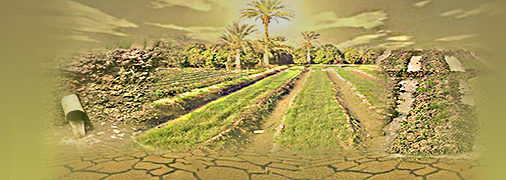
Abstract: The Western Menia area represents one of the highest priority areas for future development in the country. The studied area is located between 27 53 20.11 – 27 58 48.34 North and 30 06 41.53 – 30 13 6.57 East and represents an area of about 9078 Feddans. Using geological map, Digital Elevation Model (DEM) and visual interpretation of satellite data, a physiographic soil map was produced to present mapping units of the studied area. The area under investigation was classified into two landscapes, i.e. alluvial plain (4181 Feddans, 46.06 % of the total studied area) and terraces (4897 Feddans, 53.94 % of the total studied area) This study aims to assess and mapping soil properties for salinity, sodicity, lime, gypsum, depth and texture. Land capability was used to evaluate the soils of studied area. According to Sys model, the studied area was classified into four capability subclasses, i.e. S2x, S3t, S3d and S3d, t. The soils of S2x have moderate limitations for agricultural crops, whereas texture is the most limiting factor (48.55 % of the total area). The most limiting factor of soils of S3t is topography (12.89 %), while the soils of S3d (27.89 % of the total studied area) whereas the depth is the most limiting factor. On other, hand the soils of S3d, t (10.66 % of the total studied area) whereas the depth and topography are the main limiting factor for agriculture. Soil fertility maps were conducted for macronutrients and micronutrients.

Keywords: (Soil Mapping, GIS, Remote Sensing, Egypt)

The full text

Return to researches