


Yehia, H. A., Fayed, R. I. and Rateb, K. A. ( 2013). Integration of GIS and Modeling to Study Soil Characterization, Evaluation and Sensitivity to Degradation of Some Alluvial Deposits, Egypt.Alex. Sci. Exch. J. 34: 460 - 475.
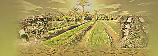
Abstract: The present study aimed to 1) characterize the main soil units, 2) evaluate the land capability and suitability, and 3) use quantitative method to map the environmental sensitivity area for desertification for some Alluvial deposits, West Delta, Egypt, through coupling between Geostatistical analysis and ALES-Arid model for land evaluation in Geographic Information System (GIS) Environment. Geostatistical analysis was carried out to map the spatial distribution of the soil characteristics, and then extract the soil mapping units from the overlaying different soil character layers in GIS environment. Finally, land capability was calculated for each soil mapping unit. To categorize soil properties, 40 soil profiles were dug to 150 cm depth, and laboratory analysis indicted that the soil is characterized by clayey texture and low salinity. The results of spatial variability and dependence in the surface layer indicate that the best fitting semi-variogram models were the gaussian model for soil salinity and SAR and the spherical model for CaCO3 and Organic matter content and the exponential model for soil depth. In the same time the optimum sampling distance for any further study of EC, SAR, CaCO3, Organic matter content and soil depth were 191, 242, 751, 927 and 504 m, respectively. Six soil units were dominated namely, low saline deep clayey soil (21.10%), moderately saline deep clayey soil (61.19%), highly saline deep clayey soil (9.62%), low saline shallow clayey soil (2.65%), moderately saline shallow clayey soil (5.00%) and highly saline shallow clayey soil (0.44%). Calculated Desertification Sensitivity Index (DSI) showed that most of the study area (64 % of the total area) is very low sensitive to desertification and about 36 % of the total area was not affected. The land evaluation results for the study area shows that the capability class C2 (Kh), which indicated moderate land capability with hydraulic conductivity limiting factor covered an area about 75.80% of the total area and C2 (Kh, Ec), which indicated moderate capability with hydraulic conductivity and soil salinity as limiting factors covered an area about 24.20% of the total area. The suitability results show that the area suitable for some crops (fruit trees, field crop and vegetables) but under specific management practices and the main limitations were soil depth, soil salinity, and hydraulic conductivity.
Keywords: (geostatistical analysis, GIS, soil units, kriging analysis, land evaluation, environmental sensitivity.)


